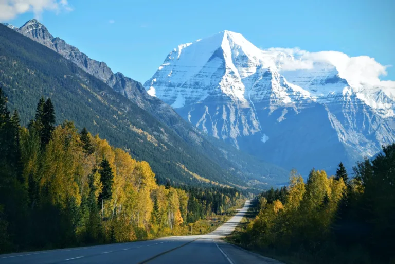
The Norwegian Fjords, an iconic landscape that truley lives up to its reputation. The dramatic backdrops carved by glaciers drawing visitors from around the world every year. Kayaking and exploring these Fjords is on most peoples bucket lists and we were no different. We opted for a multi day kayaking, hiking and camping along Nærøyfjord.
We booked via Much Better Adventures so our first evening allowed us to be transferred to Voss, meet our group and prepare for the main trip the following day with guides from Nordic Ventures. Our advenrture started the next morning at Gundavagen which lies on the southern bank of the Nærøyfjord, from here we spent 3 days exploring the fjord by kayak and foot.
Nærøyfjord
Nærøyfjord, sometimes known as Nryfjord is one of the most popular arms in Sognefjord of Norway.
Nærøyfjord is around 450m wide which makes it the narrowest fjord in the world.
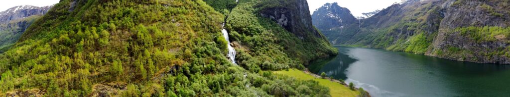
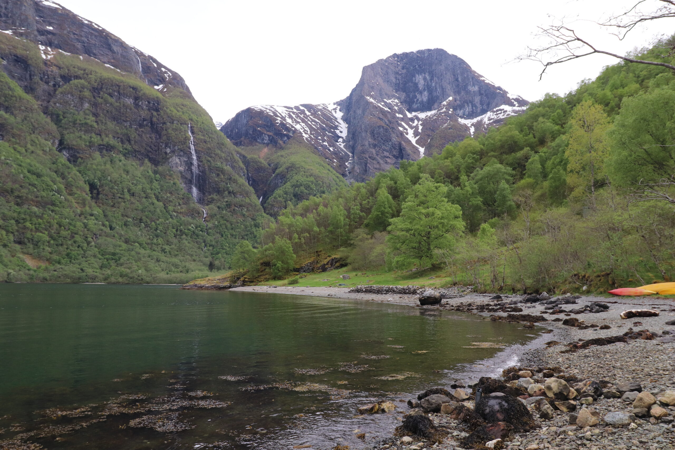
It is surrounded by stunning mountains up to 1,900 m high. This narrow wing of the Sonefjord provides impressive waterfalls, rugged cliffs, forested gorges and tiny villages for a jaw dropping lanscape. As such it is much quieter than the neighbouring Fjords with a calm and undisturbed landscape for you to enjoy with your guides away from the crowds.
Kayaking Nærøyfjord (From Gudvangen to Drydal)
Day 1.
- Start: Gundavagen
- Distance: 12km
- Time: 5 hours with lunch stop at Odnesfossen
- End: Dyrdal bada space (approx 10.5 km)
The starting point for this journey is at the Gudvangen hut for Nordic ventures. On our first adventure day we met our guides at 10am and spent about an hour and half just getting our packs ready, going over the plan and everyones experience with kayaking and hiking. We had chance to pack our dry bags, get prepared and have a hot drink before heading off. I really enjoy knowing the details and seeing the upcoming journey on a map. There is something really exciting about it.
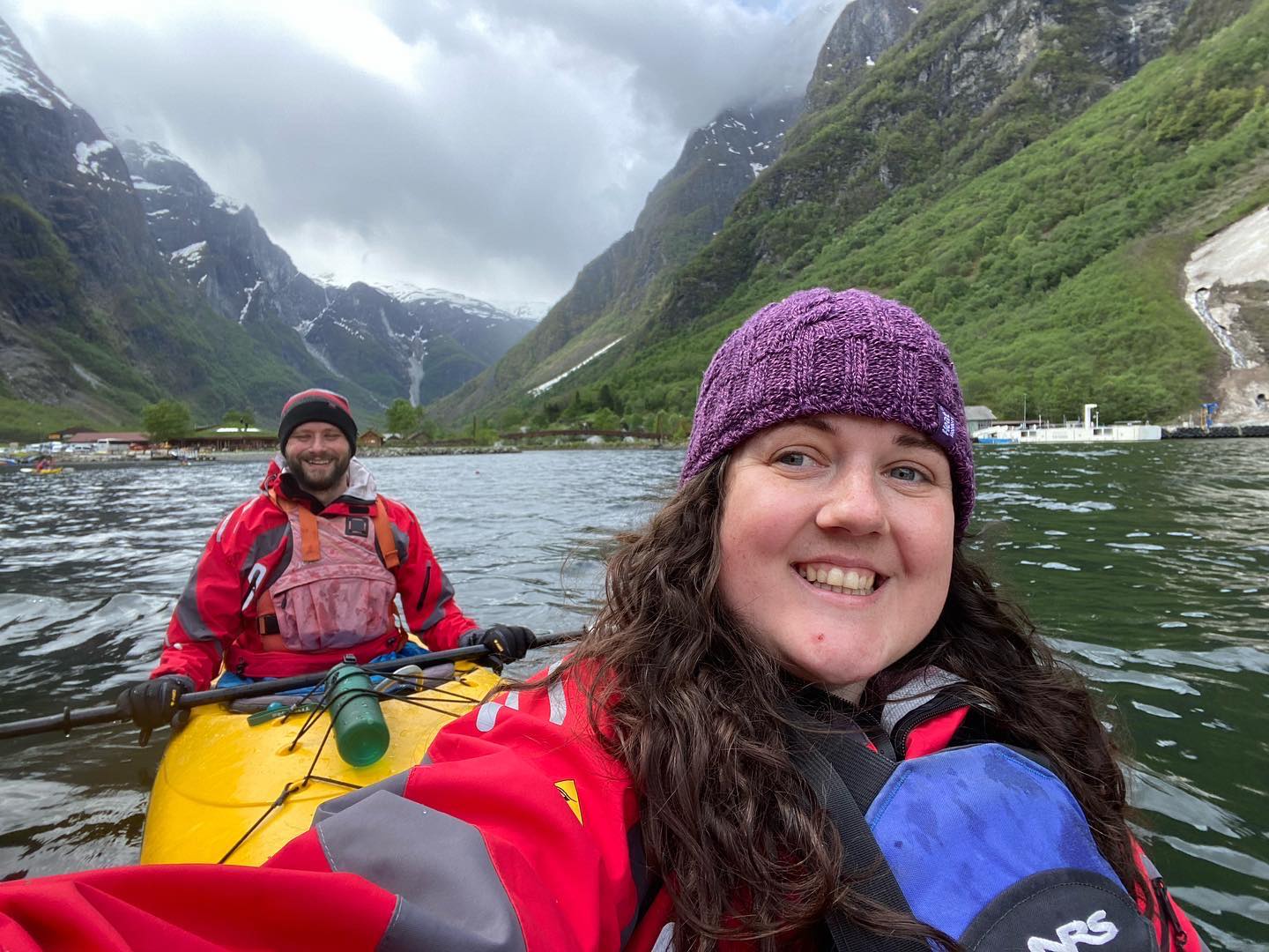
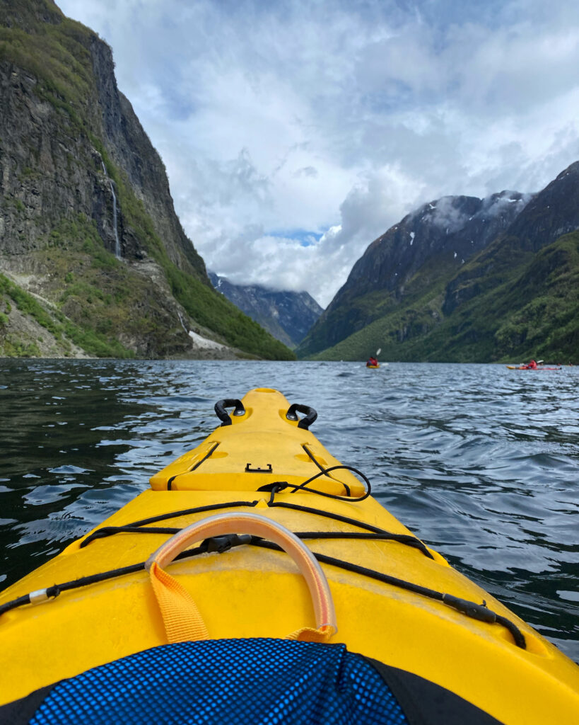
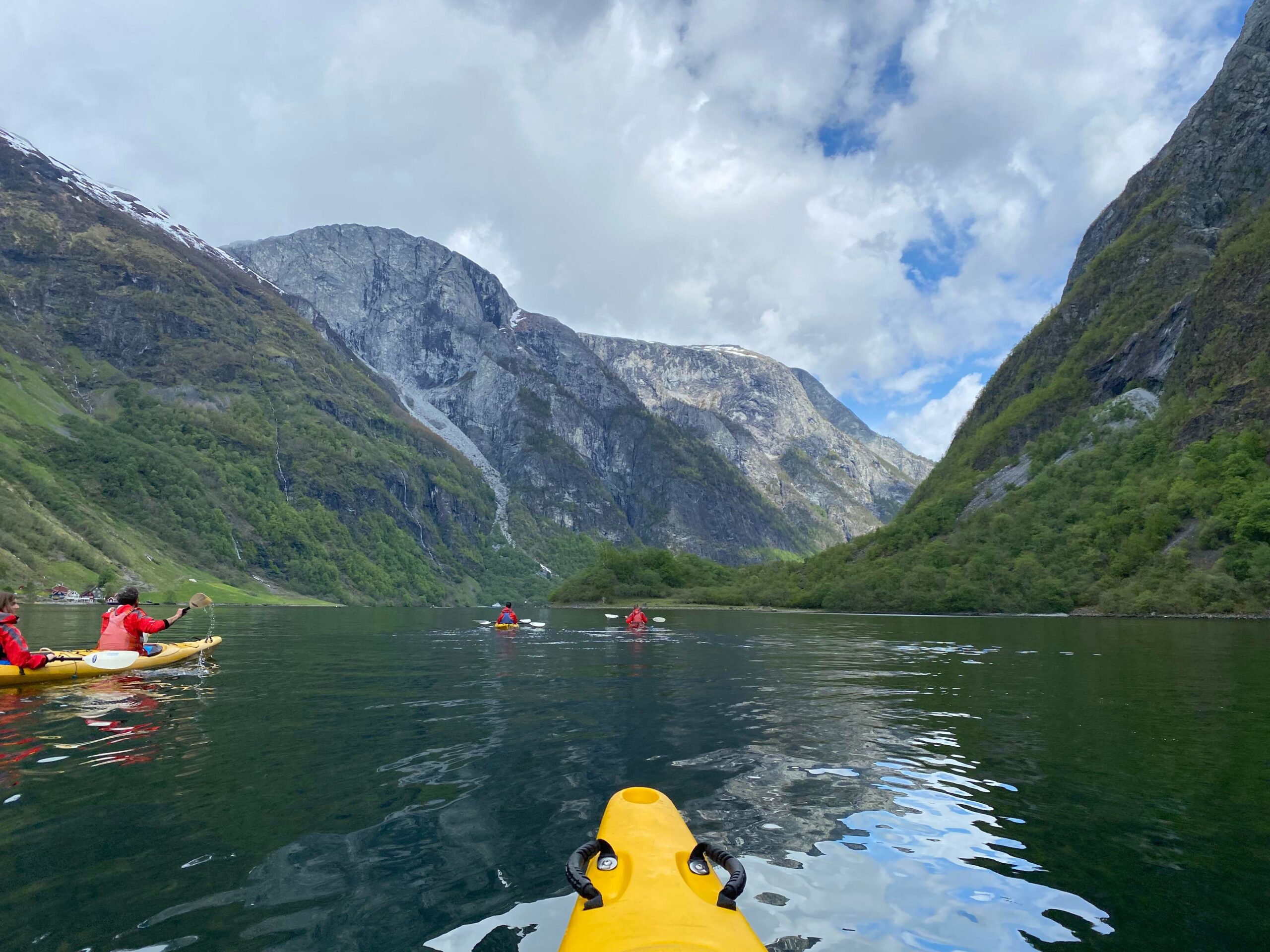
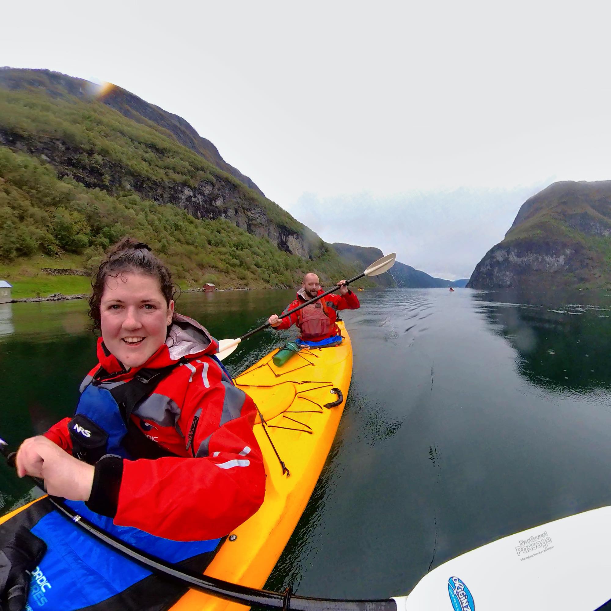
Once we set off on our kayaks we made a steady pace stopping and chatting to others alongside and just taking in the scenery. Every metre of distance covered in the kayak, brought a new perspective of the towering peaks above and the waterflls cascading down them. As a group we were fortunate to be with people who were relatively fit and just as excited as us by the scenery.
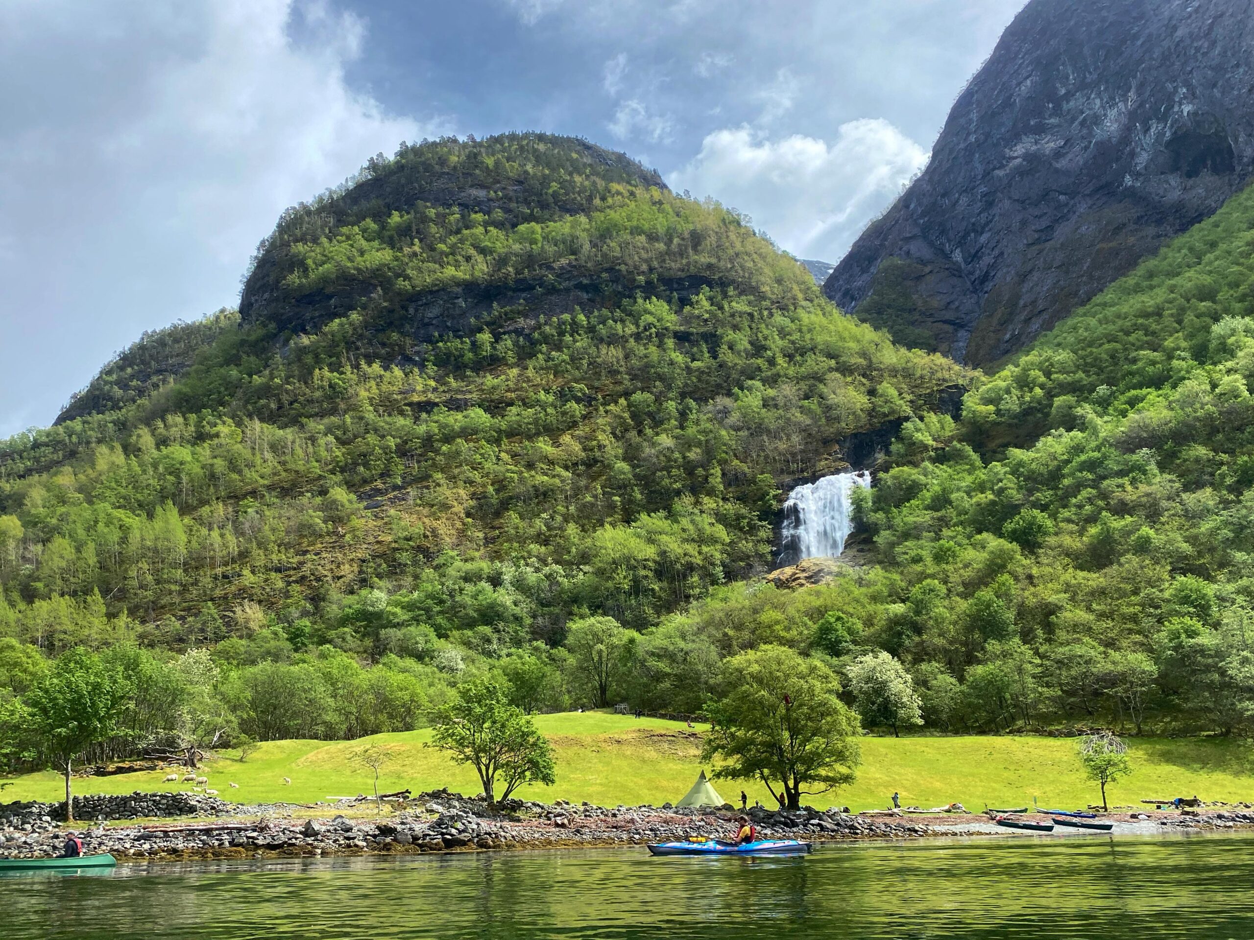
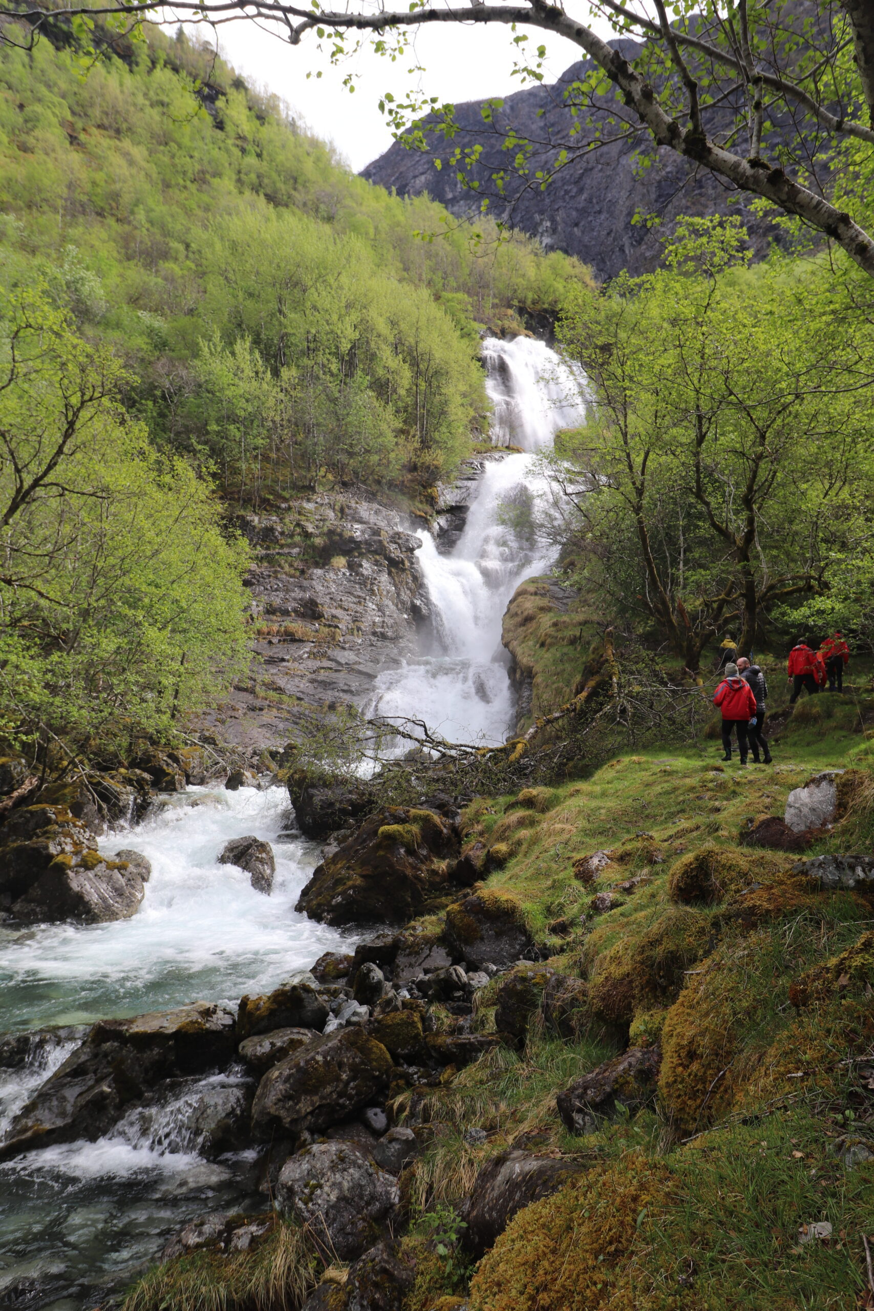
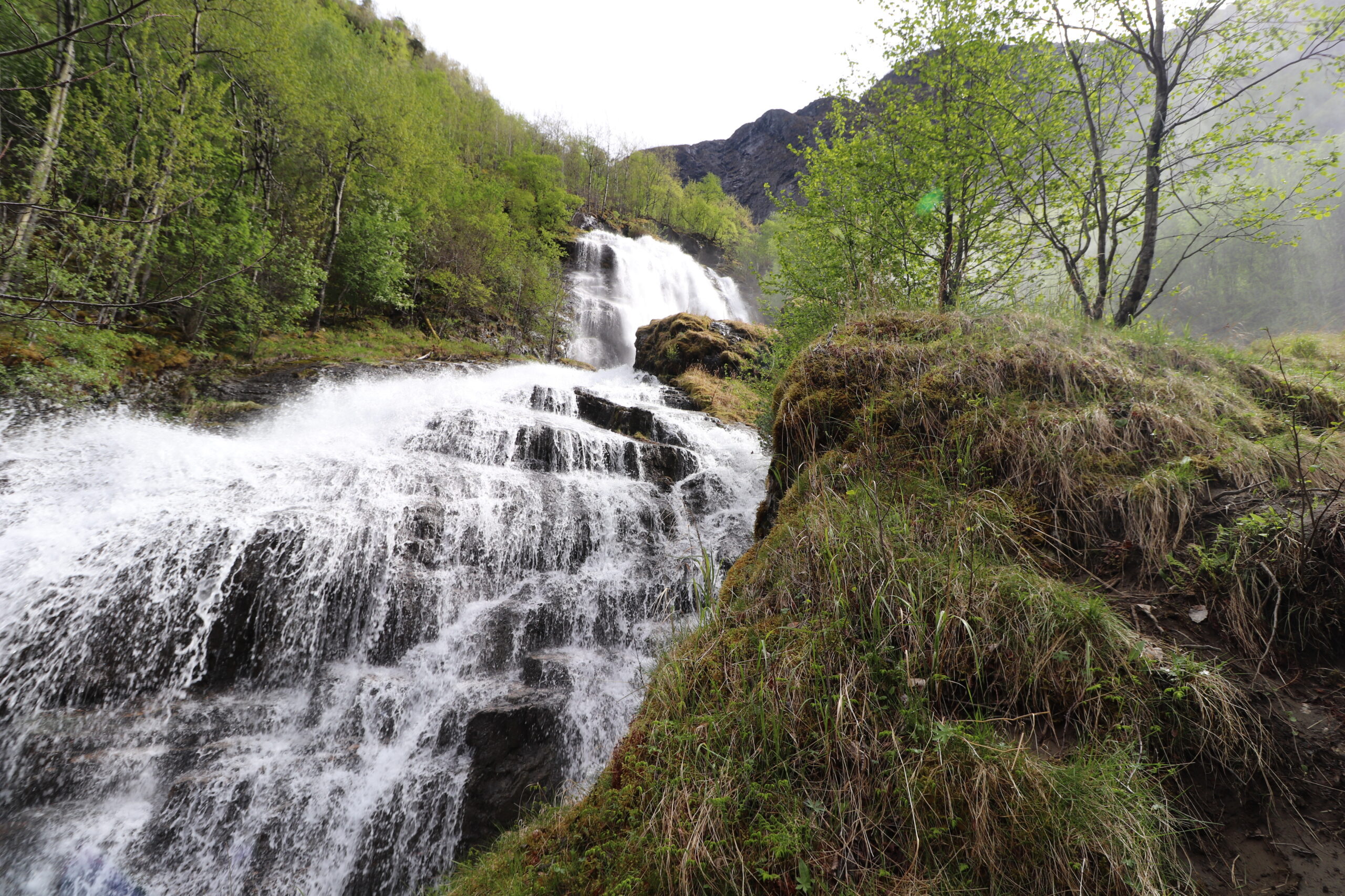
We stopped at a bay which Odnesfossen one of the many goregous waterfalls along our route where there is flatter outcrop of woodland and farmland. This area is also used by some as a camp spot. Here we had our lunch and then went for a short walk up the waterfall before spending about half an hour sat relaxing and looking out back towards the fjord in the direction we came.

After our lunch break at Odnesfossen we made our way in the kayaks and headed towards our next stop of Dyrdal Bada Plass. As we kayaked along Nærøyfjord I was amazed at how well the surreounding forest was preserved with some small traditional cabins dotted sparsly along the shores at odd points.
I was also impressed that we only saw a few boats and no cruise liners.
We did see a couple of local power boats and an electric ferry. The ferry was quite small and looked more like a big yatch. It made barely any noise and we only noticed it when it was really close and we were cutting over the following small wake of the boat.
This is miles away from what other European and U.K waterways are like which typically become flooded by overtourism and regular boats of different kinds. I was also relieved to find that the dreaded cruise liners I see advertised everywhere were nowhere to be seen (on this day or the two days following at camp, on the hike or kayaking the remainder). I think this is was added to the charm and a sense of peace when kayaking along.
Hiking To The Summit of Breiskrednosi
Day 2.
- Start: Dyrdal Bada Space
- Distance: Approx. 25 km (round trip from our camp spot)
- Time: 10 hours round trip to the summit and back
- End: Dyrdal Bada Plass
- Overall Elevation of 1500m up and 1500m down (reaching 1189m at the summit)
I woke up in the morning with a lot of pain in my hip, I struggled to lift my left leg up and flex unaided. I wasn’t sure if the pain was due to my endometriosis or my pelvic congestion syndrome but I really wanted to continue the day and get on with it. So I headed off on the trip with the rest of the group.
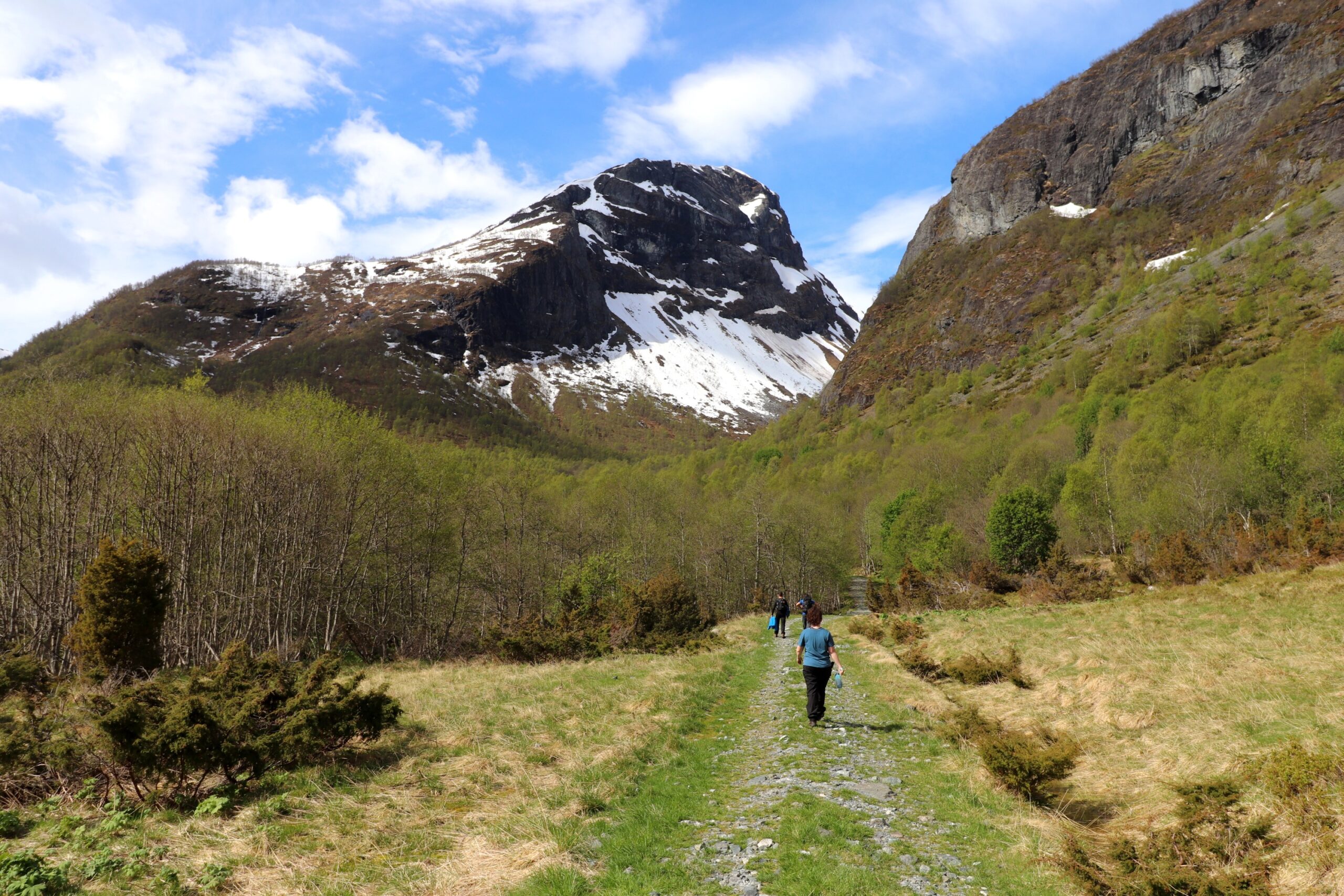
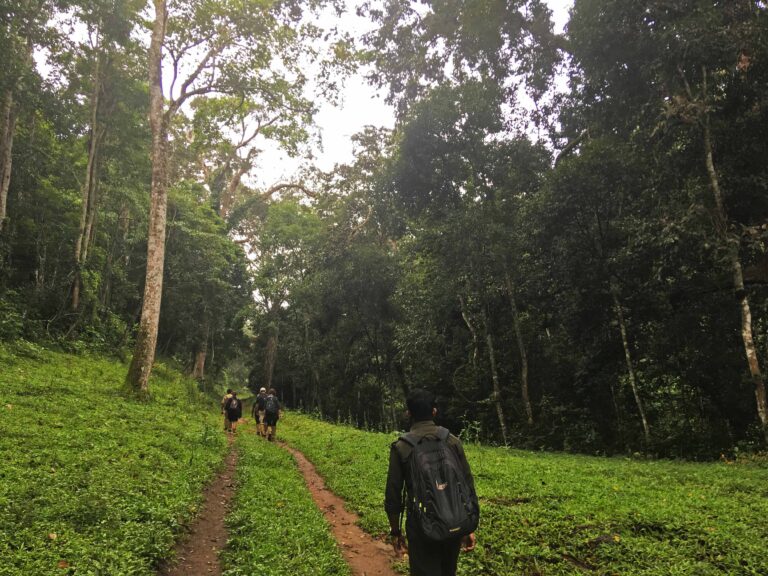
We started the hike at Dyrdal bada plass where we were camping and set off about 8:30am to the summit. We set out across a small stream that runs alongside our camp spot then along some large stones that created an ad hoc pathway to the village about 2km.
Once we reached Dyrdal we made sure everyone had water filled up from a store the guide had, then checked out the map of where we were heading. Our route would take us up a steep but maintained gravel road through the village and then around behind the the mountain up winding route before heading off tracks and up steeper inclines.
As we headed up to the top village and then further on down a gravel road and over a few bridges, my flare up was starting to slow me down and get worse. I was moving but every step felt like a mix between being dragging and a burning sensation every step I ignored (I nickname this my veiny pain), so I could distinguish this pain was the pelvic congestion syndrome, not endo. I knew it would be very painful but I was enjoying the scenery, the fresh air and the company of everyone in the group so I really didn’t want to stop.

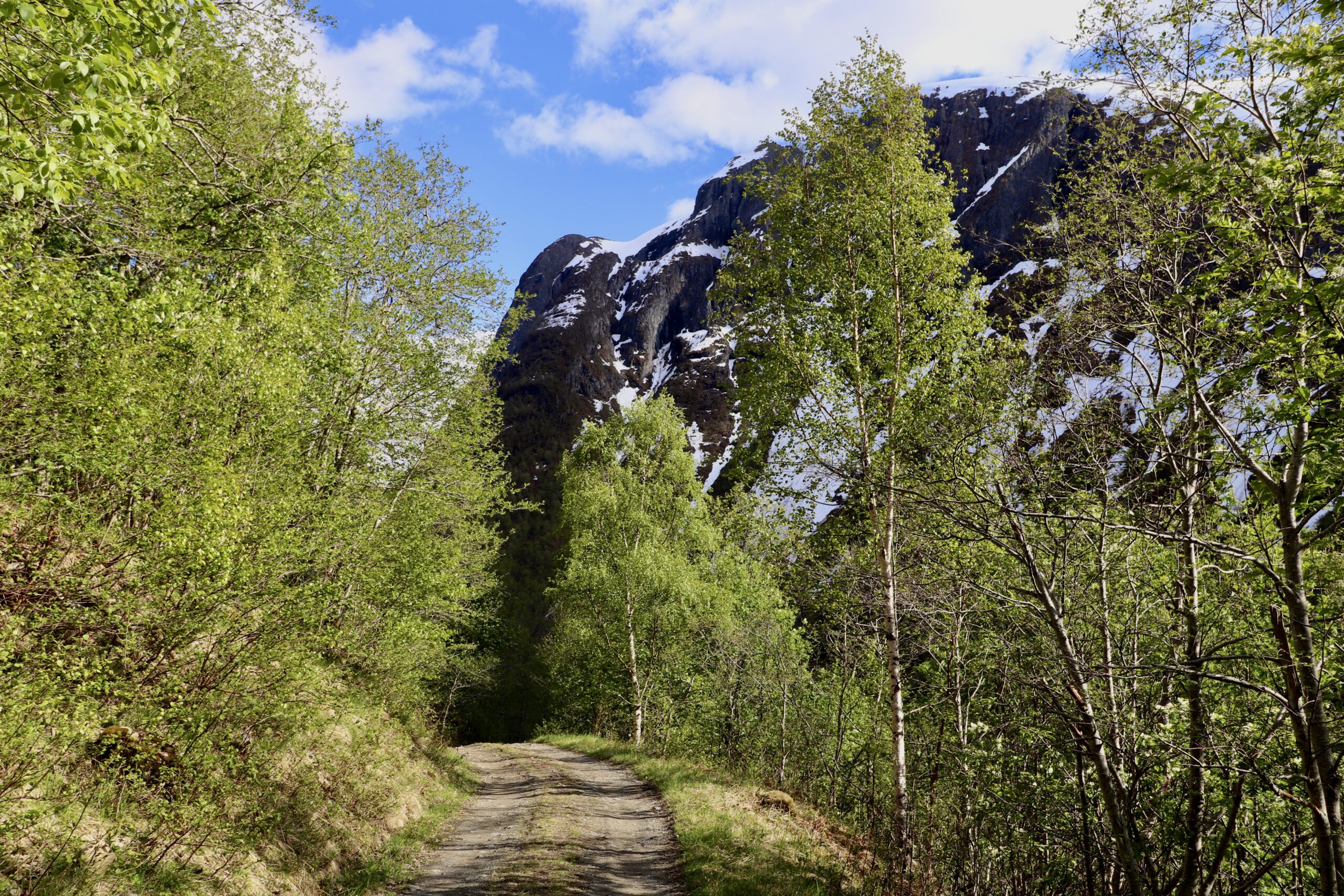
After this more steep incline took us over a fell and then along river stones before arriving at a traditional farming village in a valley. We stopped here for lunch before tackling the next part of our route.
This next part would take us away from a marked path, which much of the area being even steeper and through bog and snow. The views of the other mountains around the valley although stunning were starting to look similar and it just highlighted the need for a guide or experienced navigator to lead the group.
Because of the incline we had to zig zag up to make sure we were on a stable footing. The further elevation then brought a change in temperature and even more snow, as we looked out there was a plateau that was blanketed by several feet of snow.
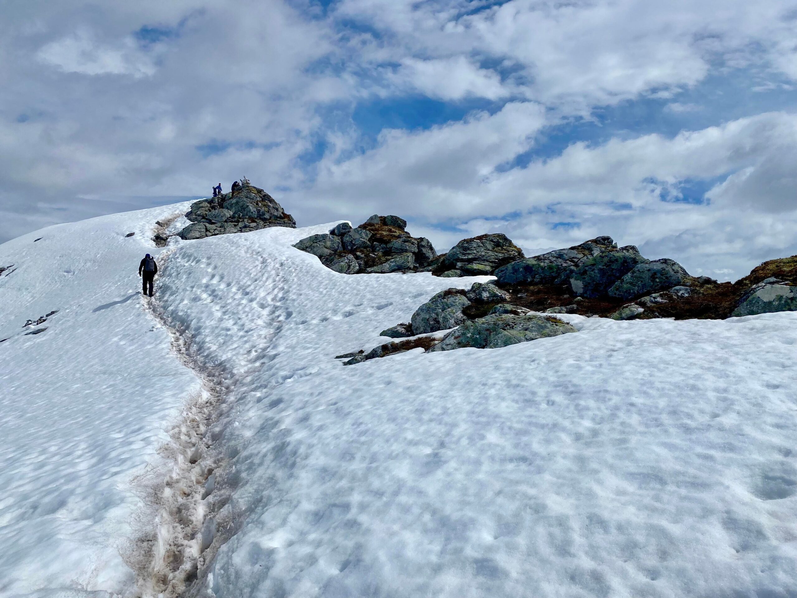
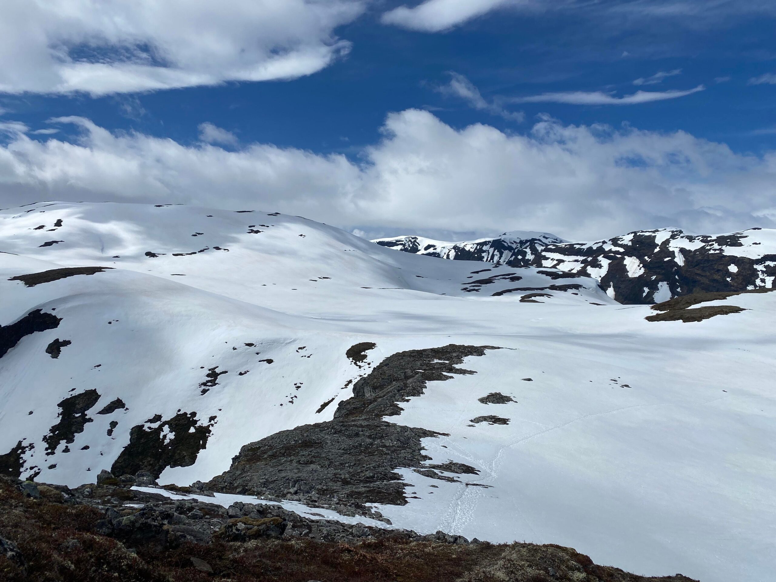
What we didn’t see or realise until we had reached the summit is that we were actually passed alongside frozen lakes. The time of year (May) meant that if we had taken a route across these lakes without a guide, it could have been very dangerous.
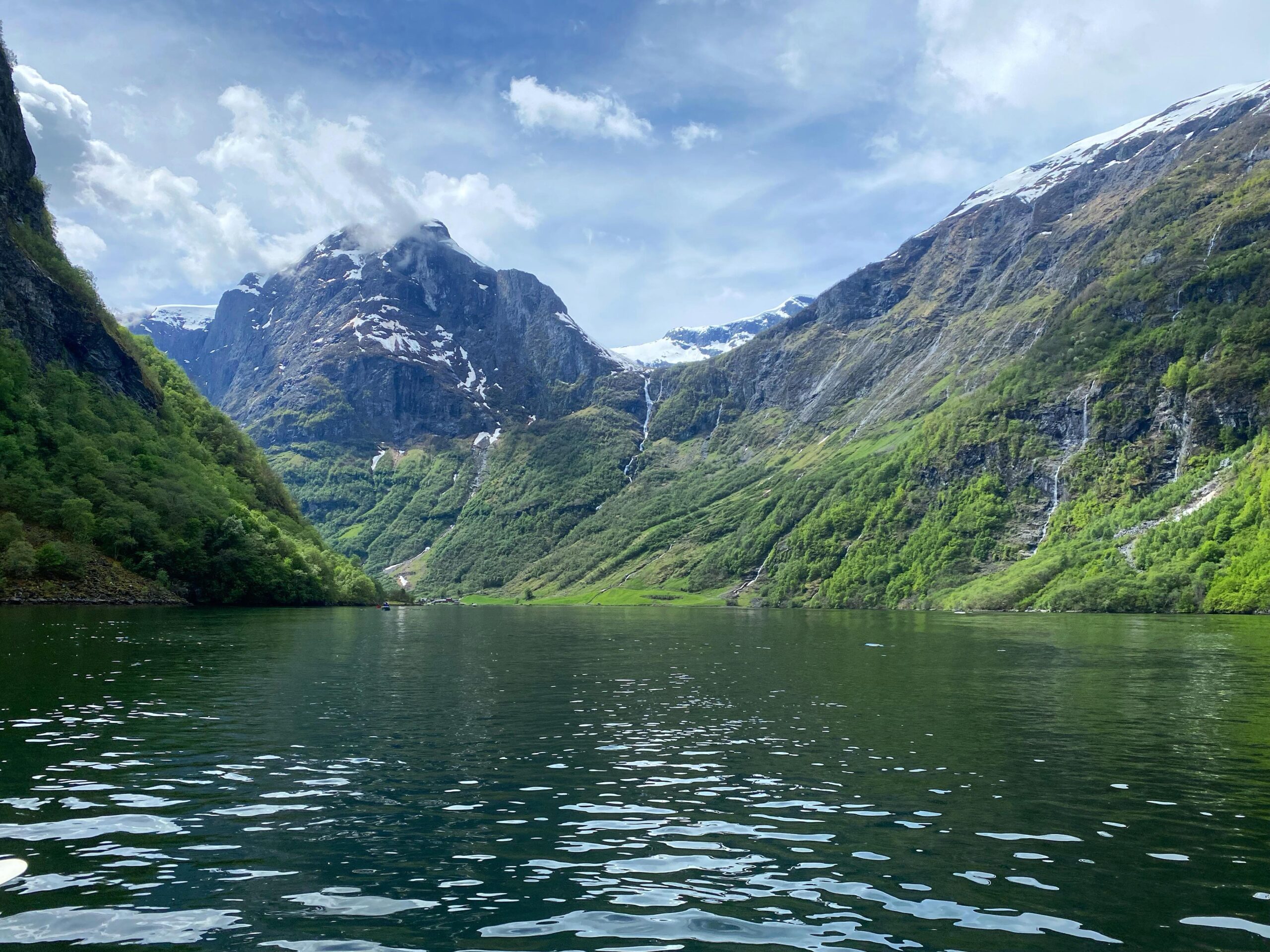
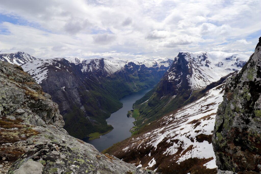
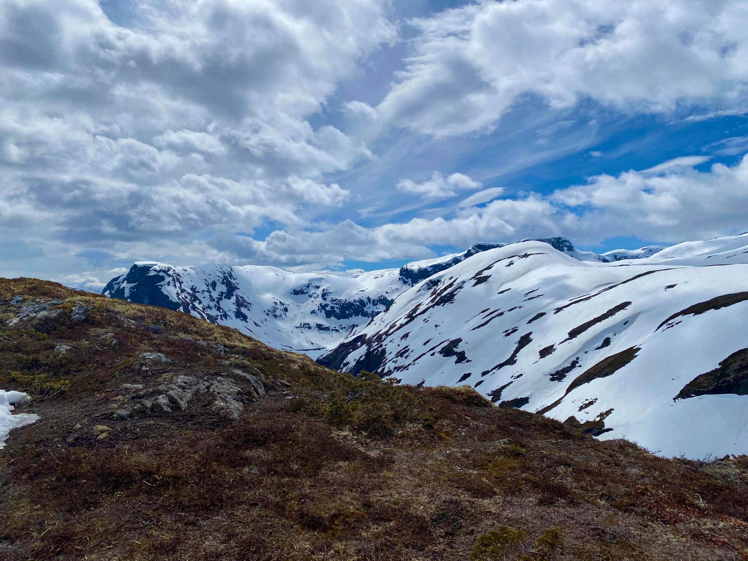
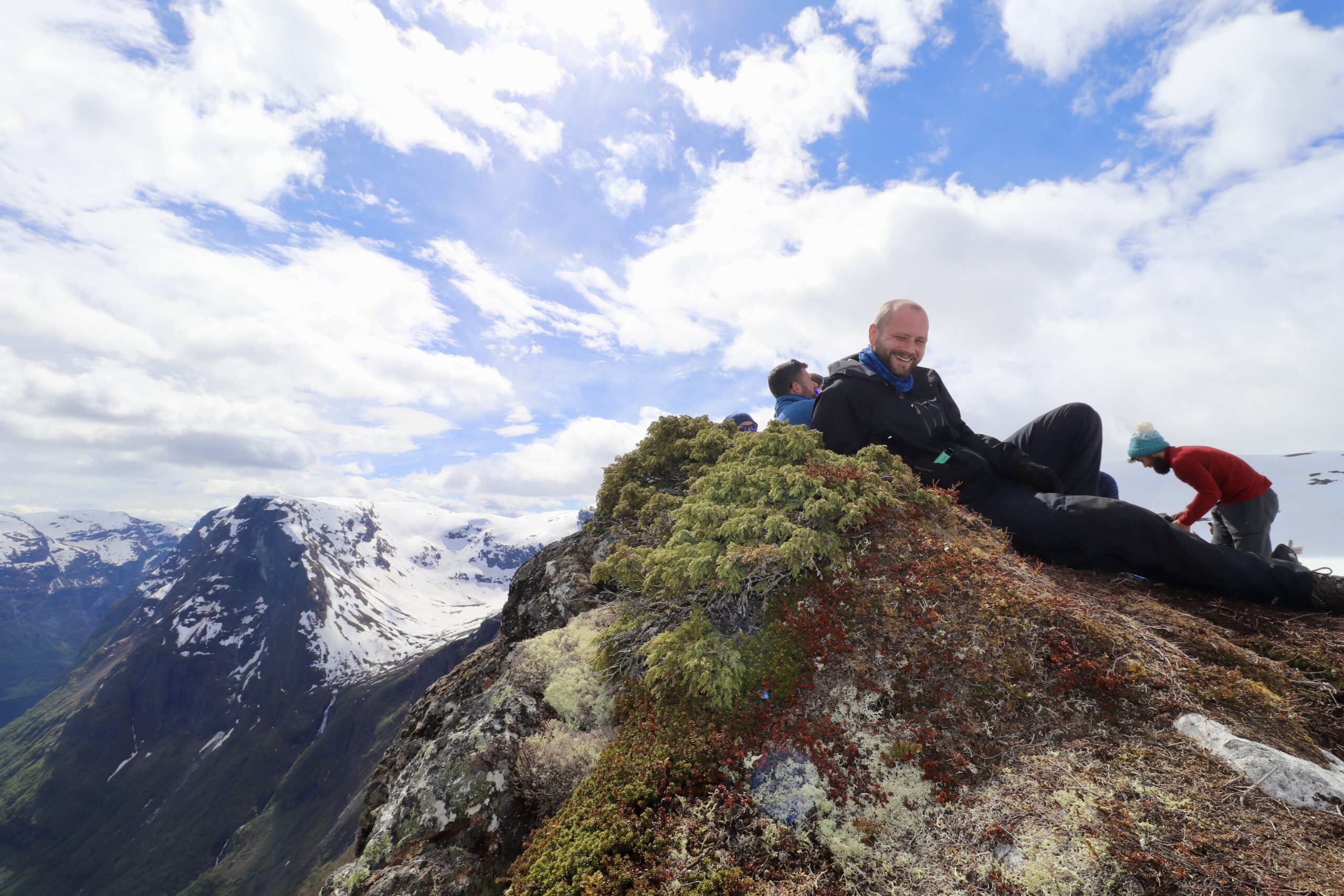
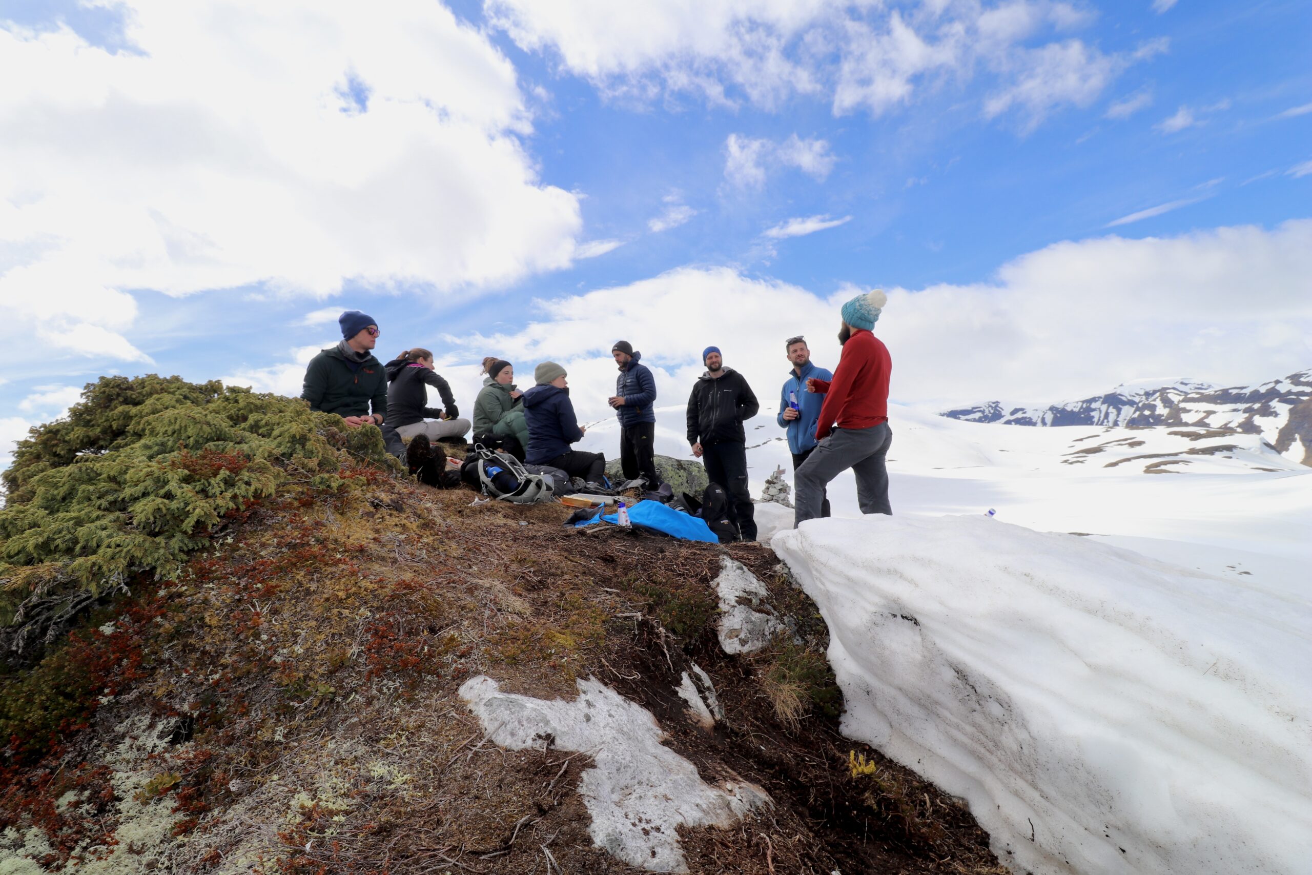
Following the walk across the plateau area we could just about see the peak through the snow with a final climb. We made our way over and our pace picked up to get to see the view that our guide had told us was worth it. We were all getting blown by the wind at the higher elevation now and looking forward to stopping for a snack and short rest whilst taking in the views. And wow what an amazing view it was, the peak gave you panoramic views down the valley and Naeroyfjord towards the route we had kayaked the day before.
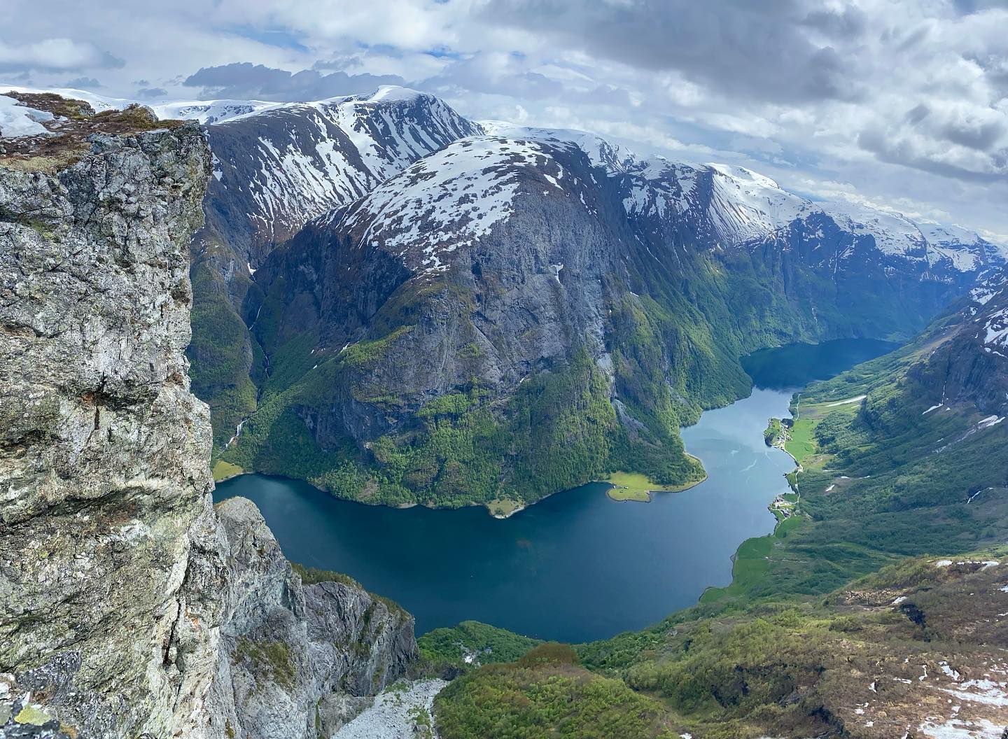
When looked down towards where we started we realised we had actually covered quite a distance in our kayaks and could see a few groups doing their own journey looking like tiny dots in comparison to the scale of the peaks surrounding them.
This route is a there and back route rather than a loop so we headed back the way we came. This time we got to view the expanse from another angle and were able to see even more mountains as the sun came out and made everything that bit more dramatic.
My pain didn’t subside unfortunately it got worse with each step. Every bit of incline proved to be a huge mental challenge. I had to oscilate my body to get momentum and then either abduct my left leg or lift it with my hands. It was frustrating and I was definitely the slow one in the group, but the guide (Iain) and whole group were brilliant and really encouraging. We still managed to get a good amount of time at the top relaxing and enjoying the views with no rush. We also kept on schedule arriving back at camp at the time planned.
Although this wasn’t the hardest of hikes or highest it still had it’s challenges (especially given my flare up). With the steep sections having breaks was definitely welcome for most, especially when the sun came out and again when we hit the snow at the top (which just made it a bit harder for everyone to regulate their temperature. Most of this hike I was just in my t-shirt and didn’t need all the layers, but still glad I had them for odd sections).
Kayaking Nærøyfjord (From Drydal to Undredal)
Day 3.
- Start: Dyrdal Bada Space
- Distance: 6.5 km
- Activity: Kayaking
- Time: approx 4.5 hours with lunch stop at Stokko
- End: Undredal along Aurlandsfjord
We set off in the morning after packing up our camp and kit. The weather on day three was a little more windy and rainy than the previous 2 days, but it was still a nice temperature. When we thought we had seen the best views that could be offered and on day 1’s kayak and day 2’s hike, we were then given more. Every turn was another dramatic peak or waterfall.
I took a lot of pictures and I just wanted to have my camera out the entire time but I resisted as much as I could on this final day even with the action camera. I just wanted to enjoy the scenery and be careful I didn’t spend my time viewing through a screen or view finder. But it is very hard not too if you like photography.

We soon came to an opening in the fjord where we turned right and headed towards our lunch spot. As we headed along Aurlandsfjord we started to see lots more goats on the cliff edges, more small buildings scattered along the edge. Up high there was also a highland farm cabin which our guide pointed out was the only dwellings not occupied during the war. He also told us that during the war the owner would throw things off the cliff to hurt and of those who got close to attempting the ascent. It was a steep and winding scrambal up to the entrance. We also saw a number of ziplines (not for leisure) but for delivery across the fjord which helped them to deliver supplies and goods. We had spotted one or two when kayaking along naeroyfjord on the first day but just thought they would be powerlines.
For the final leg of our journey we stopped at Stokko (our lunch spot) to refuel but this stop was more breif than our previous days. Todays effort felt a little harder despite the shorter journey. I think this was mostly due to camping out for two nights and the three days of constant activity.
Camping at Nærøyfjord
Dyrdal Bada Space
Our camp spot for two nights was at Dyrdal bada space which is just 2km south of the town of Dyrdal. Our space sat back from the waters edge and in the middle of old woodland. We each used spots that were already flattened and careful not to use any of the space where the wild flowers or moss was growing.
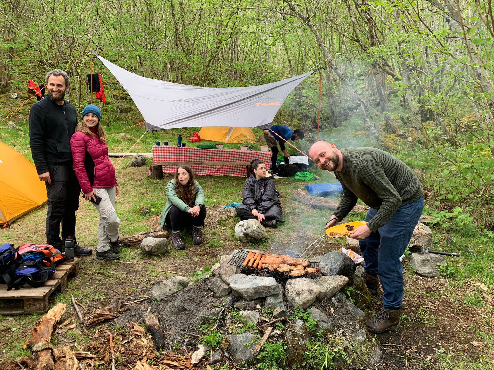
The views from the waterfront near our set back tents was just absolutely stunning, as the light changed through the evenings you could notice different detail looking across the narrow fjord.
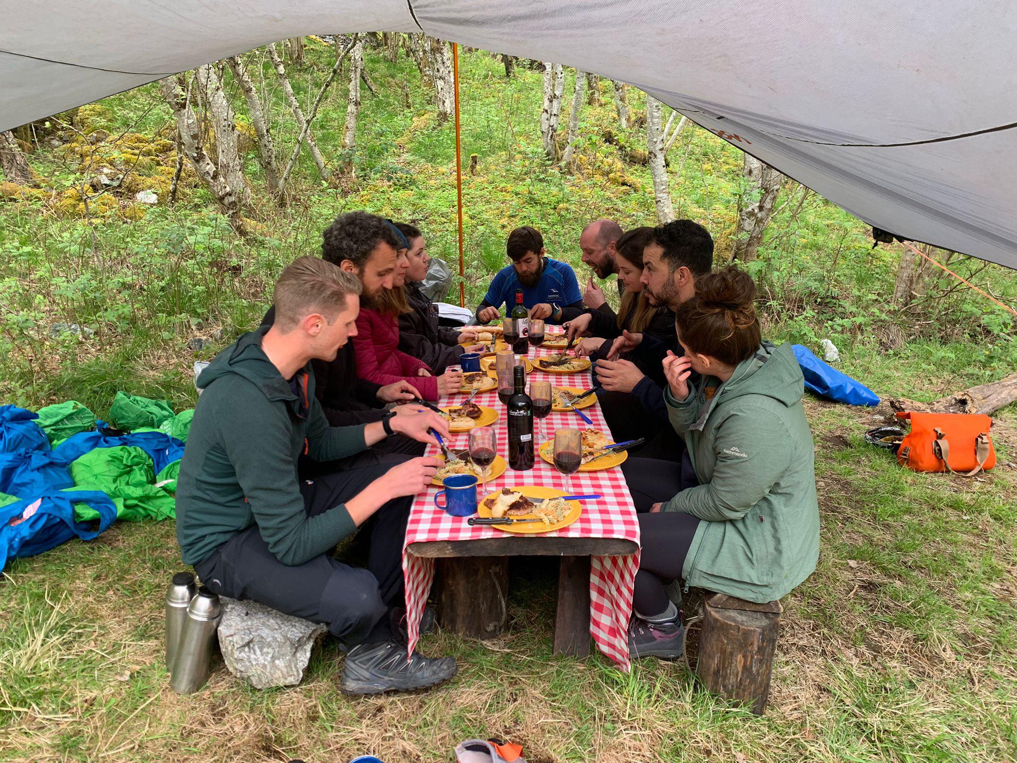
We had a campfire where we cooked a lot of our food and roasted marshmallows (though the guide had a campstove too). It isn’t a campsite so there isn’t any power, buildings or any other comforts it’s simply a beautiful quiet spot that the guides have an agreement to use. Because you are away from comforts and warmth (should the weather change). My favourite is to make my own version of a trail mix. I usually go for hazlenuts, cashews, plain peanuts or almonds, home made dried strawberries, dried pomegranites or dried goji berries. Because the weather was mild I also added in some small broken chocolate buttons too. You also can’t go too wrong with a bit of Kendal Mint Cake in the months where there is more snow or the temperature is cooler (like in early April or late may).
Long Drops
In the Fjords on farmers land there are a number of toilets. These are known as long drops. In northern america you could call them an outhouse. They are essentially a deep hold dug in the ground with a shed put over the top and a box to sit on with a hole.
This was still a welcoming site as I was prepared to have to find a place to go to the toilet outside and hovering. The guides we went with have permission to use this land with the farmers. Many of whom are traditional and would not take kindly to larger groups or extra people going on their land without permission.
I also bought a sheewee before this trip after many chats with womenclimb groups at the meet ups or other women on hiking trips but I couldn’t use it. However this could be an option if you are a woman camping in a spot that doesn’t have one.
What to Bring For The 3 Day Adventure By Nordic Ventures
If you are going on one of the guided tours by Nordic Ventures who are the main provider for the Nærøyfjord, then you will have been sent a packing list from them, but if you still aren’t sure or want advice from someone who has just done the trip.
Whats Already Included By The Guides:
You should note that you are given one dry bag per person of 20L which isn’t much space. And then you have to bring your change of clothes for the hike and around the camp (so you have something dry). There is only a little space in the kayaks for extra small items that you don’t mind getting wet.
- Kayak (Sea Kayaks both Singles and Doubles) and Paddles
- Splash Deck
- Wetsuit and Wetsuit Boots
- Boyance Aid
- Waterproof Top for the kayak
- Main Meals and Water initially but you will need to refill from the rivers
- All cooking utensils are provided and this is mostly done by the guide but get involved.
- Flasks with hot water each day (plus tea, coffee and hot chocolate supplies)
- Tents, Roll Mats, Sleeping bag (will already be at camp area, you will just need to set up your spot).
- Toilet Roll is generally there for the long drops but it doesn’t hurt for an emergency role or pack.
What To Bring With You For Kayaking
- A Small Dry bag – Both me and Ben brought our own small dry bags that we have had for years for our electronic items.
- Water Bottle (At least a litre but if you can more).
- Changing or Dry Robe
- Microfibre Towel (or travel towel that is compact)
On the sea kayaks there is a little space on top for items you may want to grab whilst kayaking or need quickly. These will need to be clipped or secured under the bungy cords and may still be at risk of losing them (i clipped my small dry bag and waterbottle under the bungy cords).

What To Bring For The Hiking
- Hiking Boots, this is more for keeping your feet dry when walking through boggy land off the trail and the snow. You will also find they have a harder sole with better tread which is better for bits where you will be steep or scrambling.
- A Small day pack that either fits in the Dry Bag or is waterproof
- Waterproof pants and Coat
- Gaitors (we didn’t have these but our waterproofs were really good and are able to tighten over the boots so they don’t ride up so easy with snow or water).
- Insulation layer such as down, fleece or hoodie
- Thermal Top and Pants (Long Johns)
- Spare pair of hiking socks
- Hat
- Scarf or neck gaitor
Consider The Time of Year:
For Context: We went at the end of May and didn’t need thermal layers. Instead just a good pair of hiking trousers that are waterproof and a tshirt. We also didn’t need our waterproof but used them to protect against the wind on the higher plateau and at the peak.
What To Bring For The Camping
- Head Torch
- Sleeping bag liner (for cleanliness)
- Thermals for sleep in
- My Changing Robe I mentioned before also doubled up as a pillow and warm comfortable jacket for the evening after kayaking and hiking
- Underwear Remember 2 days are in the kayak and wetsuit so you only need one day and then some for the evening
- Spare Socks (incase they get damp or wet on the walk
Other General Items
- Toiletries to a minimum and being conscious of the environment go for biodegradable natural products if possible:
- Biodegradable wet wipes
- Small eco friendly soap
- Bamboo toothbrush and small toothpaste
- Sunscreen (we forgot this when we saw the mist hanging over the peaks and both got burnt).
- Blister Plasters
- Paracetamol or and medication you may need
- Bring tweezers and keep them with you (for ticks)
- Snacks (you are provided with food throughout and lots of it, but you may fancy some sweets, nuts, trail mix, mint cake, energy or protein bites along the way).
Small Items That Can Store On The Top
- Camera (action cameras would be the best bet as they are waterproof and more durable but if you have space and the smaller drybag I mentioned before for other).
- I mentioned it before but a good waterbottle is a must (it’s easy to forget to drink when on the water but you will need it).
Other Fjord Tours & Ways To Explore Nærøyfjord
So to do this tour you can book directly via Nordic Ventures and get a direct quote. This is perfect if you are already in Norway and are travelling by car to Gudavegan. We booked ours through Much better Adventures to include transfers and the night before in Voss from £608. This also meant we got to know our group for an extra evening which made for an amazing atmosphere.
Nordic Ventures also offer a number of other tours from half day tours through to 10 days with the longer ones also including other locations. Check out the Nordic Ventures website here. Our 3 Day Tour costs £413.23 if booked direct (however this excludes the transfers to and from Bergen airport and the accomodation in Voss the night before and breakfast in Voss, plus transfer from Voss to Gudvagen).

This looks absolutely amazing and Norway is so so beautiful! We spend our summer in Finland and we always plan to drive over to Norway but something else keeps coming up. We did do road trips there when I was a kid. Kayaking in Norway would be so much fun.
The Norwegian Fjords are one of the most beautiful places in Europe for me. You had a great trip. Kayaking, hiking, and camping in Nærøyfjord is a fantastic adventure. I had no time to try kayaking during my Norway road trip, so I have to back there. I also haven’t reached the summit of Breiskrednosi. I hope to do that one day. Your tips on how to arrange such a trip are handy!
Wow! I love kayaking and hiking and Norway. This tour through the Nærøyfjord with the hike up to the summit of Breiskrednosi fits the bill. The scenery looks so amazing. And kudos to you that you continued despite the pain! Do you know if there is a chance to rent only the kayaks and do this trip self-guided?
This is absolutely stunning scenery, the kayaking and hiking sound amazing…ha ha not so sure about the camping bit but i’d go for the day trip of both seperately.
Wow not only did you kayak 2 Fjords, you also hiked to the summit of a glacier-topped mountain, and camped! But oh my doing it with a foot flare-up…I can feel your determination!
I have always wanted to visit the Fjords, but I had never thought about camping and kayaking there! Its such a great idea! These views are nothing like the campsites I go to near my home! Every picture you posted is stunning!
Such stunning scenery! I would love to kayak, but the 25km hike is definitely not up my alley, lol! I do love adventure-based travels and I think Norway would be an amazing place to explore.
I am so stinking envious of this trip! Norway is pretty high on my list. I’m not sure I could make it up the mountains though. I usually try to make my way down them. Is the cost per person for the tour?
Although I’m based in northern Germany which is not exactly around the corner from Norway, however, not as far as for others, I’ve been there only once. Firstly, since I’m based in the north, I tend to travel south, obviously. And secondly, I’m a bit scared of Norwegian prices – I’ve heard they are just crazy. But as soon as I’ve saved up a bit, I’ll go – your post is definitely tempting
We have such great memories of our visit to the Norwegian Fjords. We did lots of interesting day trips when we visited. But I would love to stay longer and plan to kayak and hike. Wild camping may not be on our plans! I love the sites you got to enjoy at a slower pace. Sorry to hear you had physical challenges on the hike. But some great memories
What an amazing adventures! How fortunate to enjoy these amazing scenery, looking at waterfalls from the water. And hats up to you for kept going to the summit even though you were in veinypain. Salute to your guide and the rest of the group who encouraged you to keep moving. You nailed this adventure!
Norway is a beautiful country and your trip to Naeroyfjord proves it. Your epic hiking experience to the Brieskrednosi summit is truly amazing with jaw dropping views of the snow clad mountains. Kayaking among these ginormous fjords is relaxing and of course camping at Dyrdal Nada space in woods is adventurous too.
Great Post! I have read your other posts which are really informative for any traveler. Thanks for sharing such a beautiful informative information on your blog. Enjoy yourself and more kayaking adventures
I have wanted to go to Norway and kayaking there sounds incredible! I keep seeing kayaking in the Fjords and get tempted to book. I’ll definitely look at Much Better Adventures. Thank you for sharing this first hand experience.
There are a lot of things to consider packing for this kind of trip, many I never thought about. You clearly had some adventures in a beautiful part of Norway. Good for you for continuing the hike, I would probably have given up at the start!